
Every ride helps fix the road
BumpyRide turns your phone into a road sensor. Ride like you normally would — it maps the rough pavement, the corners where riders slam on the brakes, and the near-misses that never make it into a crash report.
No account needed to browse the map.
What you get as a rider
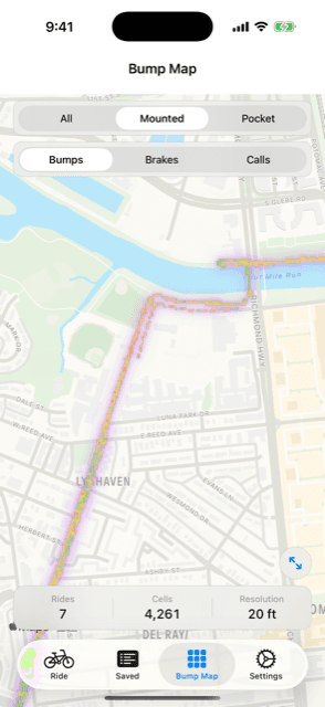
Find out which streets are smooth and which ones will rattle your teeth — before you ride them, not after.
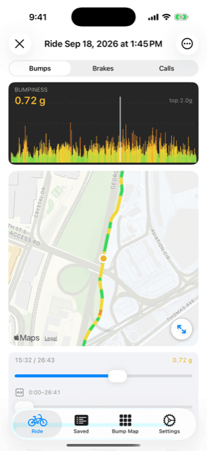
Every ride comes back as a map coloured by how rough the road was, with your hard brakes and close calls marked on it.
Blocked bike lane? Close call? One button, no typing, no menus — it works one-handed and with gloves on.
You score the most for streets nobody has mapped yet, and keep earning for coming back to check on them. See how scoring works.
Data that cities can actually use
Most of what makes a street feel unsafe never gets written down anywhere. BumpyRide is an attempt to write it down — measured the same way, everywhere, by the people actually riding.
A crash gets a police report. The hundreds of near-misses before it get nothing at all. Riders log those in one tap, with a location attached.
Not “the road is bad” — a specific 20-foot stretch, measured on many trips by many different riders.
Somewhere riders brake hard again and again is usually somewhere that needs a second look.
When a bike lane stops working, riders mark it in the moment. You get a map of where and how often.
The sensors are already in riders' pockets. Nothing to install, nothing to maintain.
The public map is free to browse and export, with no account and no licence terms to negotiate.
How it works
- 1Start a ride
Phone on your handlebars or in your pocket — both work. Then put it away.
- 2Just ride
It feels the road underneath you, notices when you brake hard, and otherwise stays out of the way. It keeps going with the screen off.
- 3Your ride syncs here
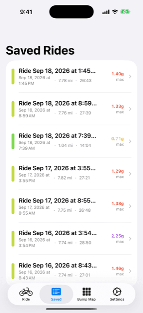
Look back at any ride on bumpyride.me, and add it to the public map if you want to.
Your rides are private until you say otherwise
- Sharing starts off. Nothing you record reaches the public map until you turn it on in your privacy settings.
- Even then, your route never leaves. Only an average for a patch of street is shared — never the path you took, never when you rode, never your name.
- Nothing publishes from one person alone. A stretch of street appears on the public map only after at least three different riders have ridden it.
- Anything you label yourself stays yours. Custom notes you add to an event are visible on your own map and nowhere else, ever.
Ride with a camera? Clip the moments you flagged.
BumpyRide Clip lines your camera footage up against a ride and cuts out the seconds around each close call or blocked lane you logged. A free Mac app that runs entirely on your own machine — nothing is uploaded. There is a browser version for Windows and Linux too.
Start mapping your commute
Free on the App Store. Your first ride already tells you something; a few weeks of them start telling your city something.
Get it for iPhone — freeThe technical details, if you want them
While you ride, the phone samples its accelerometer at 50 Hz and projects the reading onto gravity, so it measures the road going up and down rather than you pedalling or turning. That vertical component, as a one-second RMS, becomes a bumpiness score in g — one for roughly every 10 feet of travel.
Carrying the phone on your body instead of the frame adds your cadence to the signal, so Pocket Mode applies a 3 Hz high-pass filter to remove it. Each ride records which mode it used. Pocket-mode rides stay on your own map and never reach the public aggregate.
After a ride, the app re-reads it for sustained decelerations — above 2.5 m/s² (0.25 g) for 0.8 seconds or more — and tags those as hard brakes. Close calls and other events are tapped by you in the moment.
Everything aggregates onto a fixed 20-foot grid, identical on the phone and the web, so a cell means the same thing in both places. The public map shows a cell once at least three separate riders have contributed to it, and carries no timestamps, no routes, and no per-rider attribution.
API tokens for the app are stored only as a sha256 hash — the token itself is shown once when you create it and is never recoverable afterwards. You can revoke one at any time from your token settings.